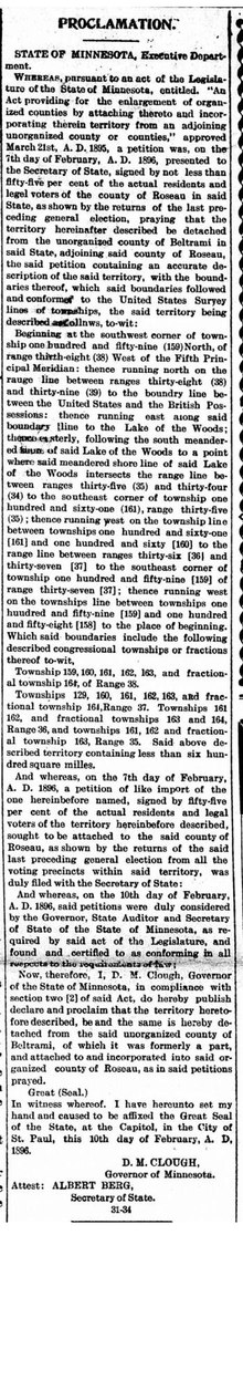
Elm Point, Minnesota
Uninhabited cape and exclave of the United StatesElm Point, Minnesota, is a small uninhabited cape and a practical exclave of the United States in Lake Township, Roseau County, Minnesota, United States. It is surrounded on the west, south, and east by Lake of the Woods, and on the north by the Canadian First Nation community of Buffalo Point in southeastern Manitoba. Part of Elm Point is privately owned and part of it is state land managed by the Department of Natural Resources as part of the Border Wildlife Management Area. It is located southwest of the much larger exclave known as the Northwest Angle. There is a line of felled trees marking the international border, which runs nominally along the 49th parallel, although in this area it runs slightly to the south due to 19th-century surveying errors.
Read article


Top Questions
AI generatedMore questions
Nearby Places
Lake Township, Roseau County, Minnesota
Township in Minnesota, United States
Warroad International Memorial Airport
Airport
Buffalo Point First Nation
Indian reserve in Manitoba, Canada
Warroad River
River in Minnesota, United States
Warroad High School
Public high school in Warroad, Minnesota, United States
Longworth, Minnesota
Unincorporated community in Minnesota, United States

Warroad–Sprague Border Crossing
Port of entry on the Canada-United States border